The Fitness and Healthy Food Sources Walk Maps were designed to map and connect residents to current healthy assets while being cognizant of obstacles such as areas of high crime.
The maps show the walking time and distance connecting each healthy asset assuming a walking speed of 3 mph. The maps show the fastest and "safest" routes by circumventing statistically significant crime hot-spot areas.
The following maps were inspired by Bickerdike Redevelopment Corporation's "Humboldt Park: Healthy Corridors" initiative. The initiative aims to lower obesity in Chicago's Humboldt Park neighborhood through coordinating existing healthy networks, mapping healthy assets, and connecting residents to resources.
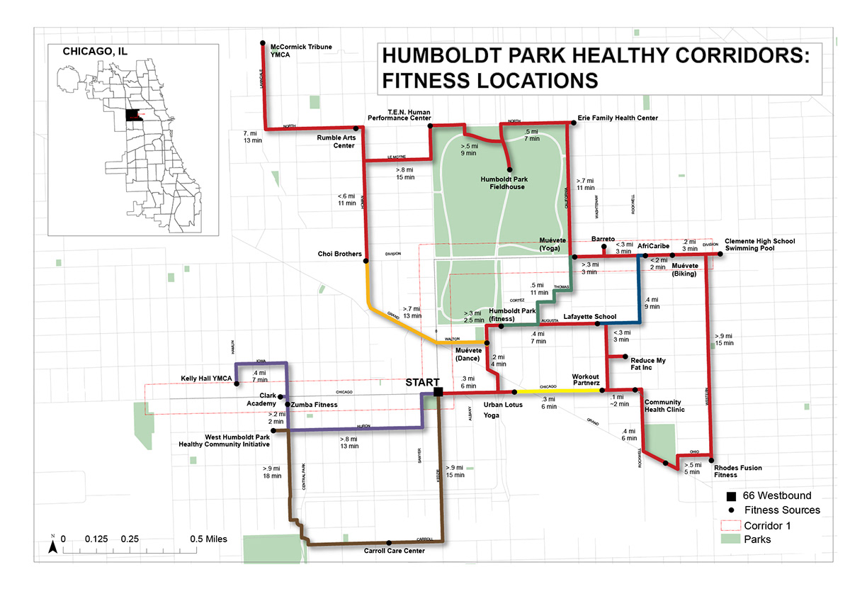
This map connects residents to fitness assets. Time and distance are labeled between each asset. The starting point lies at the 66 Westbound bus stop which is the 2nd most populated stop in Humboldt Park and is most centrally located.

This map connects residents to healthier food options.

This poster shows the workflow it took to create the two maps. Aggregating crime data, choosing crime hot-spots, finding destinations within 25 minutes, and then creating routes which circumvented the routes were all a part of the process.

The Fitness Locations map before crime hot-spots were circumvented. This is also before it was finished in Adobe Illustrator.

Routes are created circumventing crime hot-spot areas.

Healthier Food Options map before safest routes were executed and map was finished in Illustrator.

Before routes circumvented crime hot spots.

After routes circumvented crime hot-spots.
